

Here you can find a large amount of information, maps, books, documents, and personal knowledge on the Sacramento River.
A document from the library
Sacramento River Bank Protection Project Sacramento River and Tributaries Breach at Road 29 Near RM 188 Glenn County California
This report provides needed information concerning the hydraulic functioning of County Road 29 located in Glenn County California. Also contained in this report are additional hydraulic modeling results related to potential cutoff scenarios and possible modifications to the Butte Basin flood relief structures.
An image from the library

A map from the library
Sacramento River Flood Control System
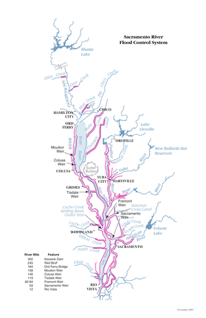
A schematic map of the Sacramento River Flood Control System.